![]()
AIRFIELD ENTRY INFORMATIONS
- ICAO code: LIDP
- Open SR-SS +/-30
- Elevation ARP 2245 ft amsl – THR02 2255ft/THR20 2223ft
- Airfield Coord. 44° 19’ 20” North 10° 49’ 54” East
- Uncontrolled airspace (MILANO FIR)
- Nearest controlled airspace : Bologna CTR on frequency BOLOGNA APPROACH 133.775
- RUNWAY 02 preferential for take off and normally in use
- Standard traffic pattern for both runway
- Respect, for safety, the suggested approach route
- The suggested approach altitude of 3600 ft permits to maintain the runway in sight
APPROACH PROCEDURE FOR RUNWAY 02
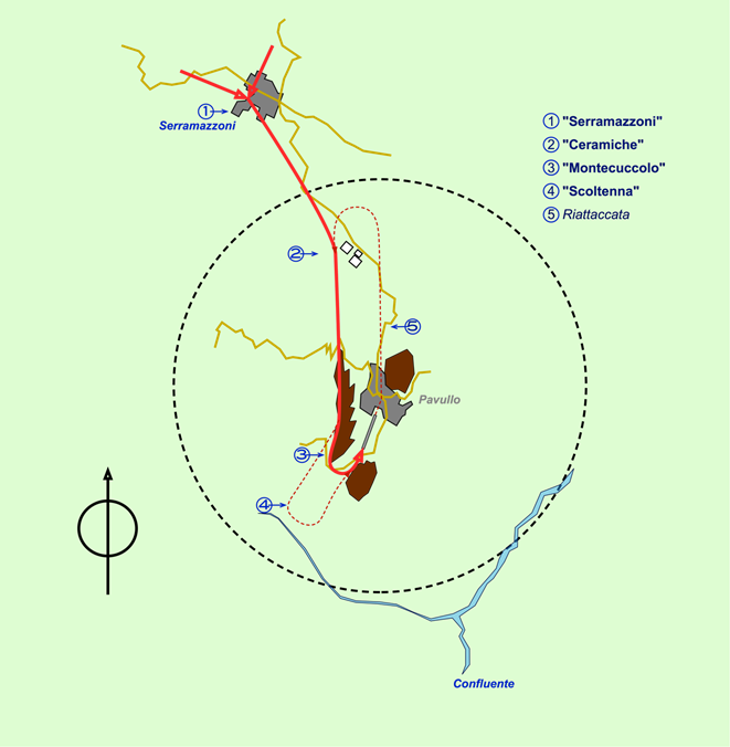
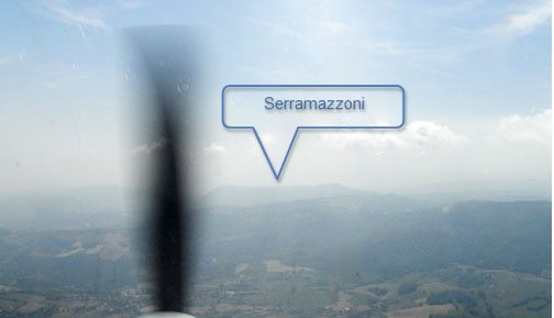
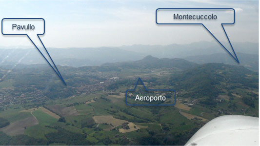
Reach Entry point 1 “SERRAMAZZONI” at 3600ft on the QNH (coord: 44° 25’ 30”N 10° 46′ 48”E)
Proceed until POINT 2 “CERAMICHE” (a group of clearly visible sheds), then assume heading south. Now you are joining left downwind 02
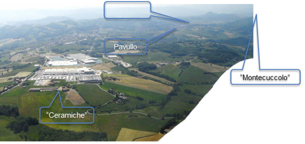
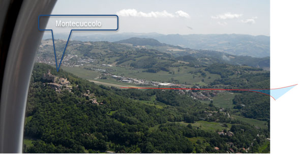
Reaching POINT 3 “MONTECUCCOLO”, you are at the end of mountain ridge that is at your left wing
Now perform, at your discretion, the left turn and descent for base and final 02
In case of missed approach for runway 20, perform go around runway heading until Pavullo city, then assume heading north in order to rejoin traffic pattern at POINT 2 “CERAMICHE”
APPROACH PROCEDURE FOR RUNWAY 20
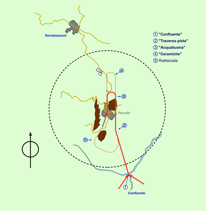
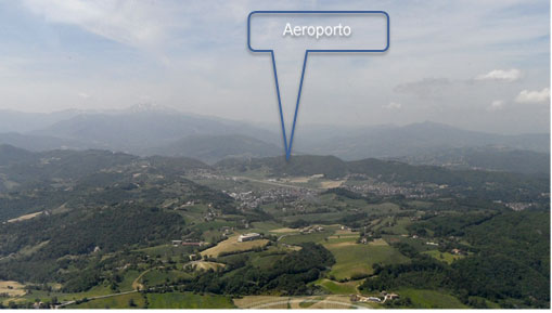
Approach the field from ENTRY POINT 1 “CONFLUENTE” (coord: 44° 16’ 06”N 10° 52′ 42”E ) at 3600 ft on QNH
Assume heading in order to reach the abeam of threshold 02 (POINT 02)
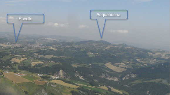
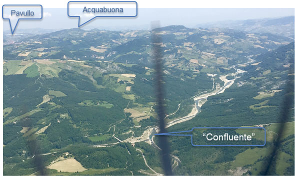
Proceed to the east boundary of Pavullo city, then turn around the low mountain ridge POINT 3 “ACQUABUONA”

Join final 20 and descent at your discretion
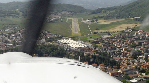
In case of missed approach for runway 20, proceed runway heading and turn around,with a left turn, to the mountain ridge. Rejoin the traffic pattern from POINT 2 “TRAVERSO PISTA”
RADIO COMMUNICATIONS ON APPROACH
- Call PAVULLO RADIO on frequency 124.980 with the runway in sight , in order to obtain information about runway in use
- Proceed for the entry point
- Call joining downwind and final for landing information